Friday, October 31, 2014

Alice Springs NT to Port Augusta SA.

We have been in 'transport mode' for two days now. Moving South to Port Augusta to reach a different Starting Point for our Westerly Trek.

First night out we stopped at the NT/SA Border Rest Area, but we were still in NT. Seventeen years ago we camped in the very same area and there were no facilities of any description there, just an open space. The area must be a popular stopping place because now there are toilets, Information Boards, 6 caravan bays and about 16 car bays all level and all sealed with bitumen. There were two caravans already parked. One of them we already knew. We unpacked our fold-up chairs and settled in for the Grey Nomad's favourite past time, forming a Chat Circle.

The second day was a full-on driving day for us, about 5.5 hours. We had chosen an earlier stop-over on the map but when we got there it was completely "open" and perched on top of a hill. We went on to Ingomar North RA at about 50 km South of Coober Pedy. Here we had a roof-top camper and two trucks for company. I slept twice as long as I drove the previous day!

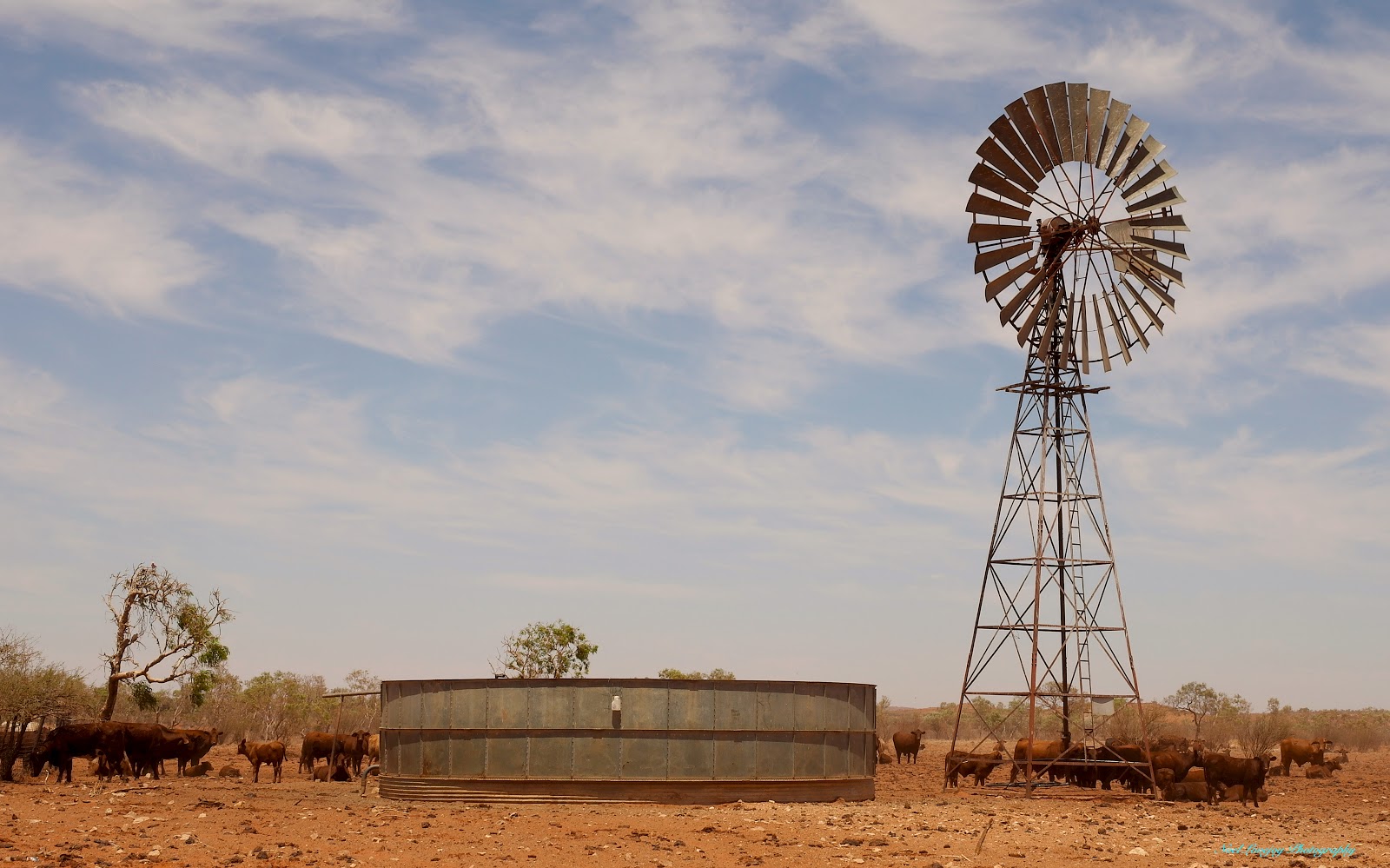
Nights 3 and 4 we stopped at Pimba Rest Area. Pimba now has a population of about 40 people. It was once the base camp for the Railway Construction Crews. As Woomera is a Restricted Area, Contractors were also based here at one time. Pimba also hosts "Spuds Roadhouse". This place is a popular meal stop for the many truckers driving The Stuart Highway. Jude also had her Birthday Dinner there.

The road side up to The Ayres Rock turn off is quite spectacular, you are driving through a series of colourful ranges. After that point most of the distance to Pimba was a "wasteland". The only trees being on the sandy rises, otherwise it is completely treeless. About 20 km North of Pimba you start to see Dry Lakes. Lake Hart is quite spectacular as it is a shimmering white salt lake. From Pimba to Port Augusta, a distance of 173 km, we were seeing a series of dry lake depressions, treed sandy rises and more wasteland treeless flats that can carry up to 16 sheep per square kilometre. The first sign of civilisation only became evident at the 6.3 km point from Port Augusta.

The wide open spaces at Ingomar Rest Area late in the evening.

The North section of Lake Hart.

The South section of Lake Hart with an Ore Train passing in the foreground.

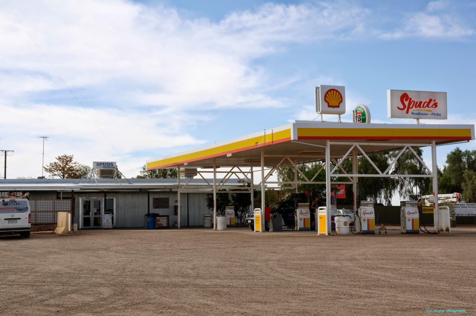
Spud's Roadhouse Pimba.

Well equipped amenities at The Pimba Rest Area.

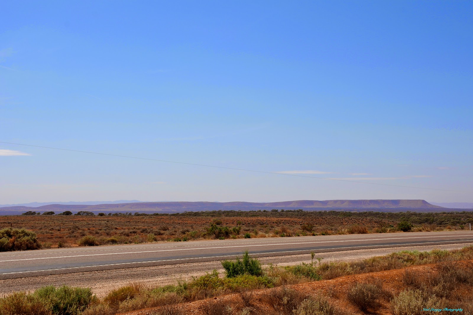
Coffee Break about 68 km North of Port Augusta with The Southern Flinders Ranges in the background.

Thursday, October 30, 2014

Alice Springs, NT

Our main aim during our stop-over in Alice Springs was to obtain Transit Permits to enable us to travel through Native Title Land. Dealing with the Central Land Council (CLC) of NT was a breeze. They cheerfully gave us a 21 day Transit Permit to cover our travel in the NT. NO Problems!. I needed to apply On-Line to the Department of Aboriginal Affairs (DAA) in WA for Transit Permits from the NT Border across to Laverton WA. This is a distance of around 871 km on gravel roads. I made request for a Transit Permit for 5 days and explained the reasons why we needed that amount of time to travel the distance. I was initially estimating that the travel would take us 6 days but I cut it back by a day to enhance our chances. I received a direct (terse) reply that I had been granted a Transit Permit for less than 3 days, no longer, and I must be through before the expiry date. Well, I am not going to punish myself, our vehicle or our caravan to please some Bureaucrat sitting in an office some where. The whole purpose of driving across The Centre Road was to take in the country along the way and to see what the early explorers, surveyors and first settlers had to endure to open up this vast tract of land. NOT JUST TO GET FROM POINT A TO POINT B.

Much to my disappointment our route to Perth WA will now be via South Australia and The Nullarbor. I wonder how much business and public interaction the people and traders along The Centre Road are missing out on because of these closed minded DAA Bureaucrats with some sort of agenda are issuing insane and unusable Transit Permits to travel on a Public Road. What is more, I now vow never to spend a dollar in any Aboriginal Enterprise in WA.

This is our camp site in Wintersun CP in Alice Springs. We are situated under a "Rattle Pod" Tree. That is not it's real name as you would have guessed.

The seed pods from the Rattle Pod tree dry crisply and retain their seeds for a time. When a breeze shakes the tree all the seeds rattle like crazy. The pods are about 175mm to 225mm in length. Two seeds remain in this pod.

29 km North of Alice Springs is this marker denoting the crossing of The Tropic of Capricorn.

This marker 19 km North of Alice Springs denotes the point of the highest elevation on the Stuart Highway between Port Augusta and Darwin.

We took a drive out to Standley Chasm and walked through while the sun was shining in on one wall.

Many flowers blooming on the sheer walls of the Chasm.

Standing in The Todd River Causeway, Alice Springs.

Directly opposite the Causeway is, of course, The Todd Tavern.

Friday, October 24, 2014

Tobermorey Station to Gem Tree, NT.

We only saw 3 on coming cars on The Plenty Highway en route to our intermediate stop-over at Jervois Station. The country has turned very arid. The south side of the road is the boundary with The Simpson Desert, but the north side doesn't look any different. Our jar of Instant Coffee came to grief on this road. It bounced upside down and then the lid came off. Dried Coffee in the cupboard, down the wall, over the bench-top and then across the floor. The joys of caravanning on badly corrugated roads. Eventually made camp at Jervois Station. This is very different to Tobermorey. Very dry and dusty here. We have learned here that the worst of the road is yet to come!! Bring it on, we have been travelling down to 30 kph already.

Sometimes stupid statements issue from my mouth, the above is one of those times. After 5 km of moderately rough road we hit the Bull Dust. Two hours later we are still wallowing through the Bull Dust at a steady 20 kph. That is second gear, 20 kph for two hours and it didn't improve much after that until about 60 km from Gem Tree. We were planning rest stops but there was nowhere safe to pull off the road. All the roadside was soft sand, if we went in there that would be where we stayed. I think we were driving, er crawling along for about 6.5 hours non stop.

The Plenty Highway was freshly graded by a pair of road graders for about 30 km until the bitumen began for the final 30 km into Gem Tree. What a relief!

Gem Tree is on Private Property and is a Mecca for Gemstone Fossikers. Garnet and Zircon are the two stones sort after.

Even way out here there are road workers with too much idle time.

I think this must have been a coffee break on the way to Jervois.

Bald Hill. I will stop for anything!

More desert. That is all there is here.

Cattle around the troughs at this windmill.

I kept one eye on this fellow, he didn't look too friendly.

One Nissan Patrol that didn't see the end of the trip. We saw many abandoned vehicles, most of them burned out. We also noticed many car parts and also a caravan water tank.

Just another Mesa. I can't remember the name of this one.

Termite mounds out here are all very large but this is the daddy of them all.

Jude disturbing the peace at Jervois Station with her Ukulele.

Great Ghost Gum in the camp ground at Jervois Station. There was only two campers here last night.

Our camp at Gem Tree.

Function shed at Gem Tree.

The Office and Store at Gem Tree.

Thursday, October 23, 2014

Boulia, QLD to Tobermorey Station, NT.

We didn't leave Boulia very early after I spent an hour or more with a hacksaw blade cutting away a ventilation portal in the roof of the caravan to enable the refrigerator to breathe! My efforts seem to have NOT been in vain as the refrigerator is now maintaining temperatures below 6 deg C. The first night out we made camp at Georgina River Crossing  Rest Area. We had a perfect shady but very dusty camp site beside the river, albeit without any water in the river! We heard at least 2 dozen road trains pass The Crossing, all of them heading East towards Boulia.

By travelling on the wrong side of the road the following day we were able to travel on a relatively well swept road. Our camp that night was Tobermorey Station, just over the border in Northern Territory. Tobermorey Station is 1.5 million acres and the Company also owns the Linda Station over the border in Queensland. Between them, the two stations carry 12000 head of cattle on the Mitchell Grass Plains. Dispersed through the plains are stands of Ironwood, Mulga and Gidgee trees.

In Queensland we were travelling on The Donahue Highway, on many sections, even towing a near 3 tonne caravan, I could have safely managed a speed of 80 kph, BUT, when the road surface changes it changes rapidly, so I maintained at a safe and leisurely 60 kph most of the way and slowed where appropriate. For example one must slow markedly for Cattle Grids and Floodways. Not much wild life out here, dead or alive but we did see one Frill Necked Dragon skittle across the road. Yes, he made it!!

Our very shady camp site beside The Georgina River.

Because these areas have not had any rain since February The Georgina River was only a gravelly river bed. But be warned, this river will flood even if there is no rain in these parts.

Tobermorey Station is a veritable Oasis around the Homestead and the camp ground.

Of course they have their own helicopter! Parked on the lawns in front of the workers quarters. Several Poddy Calves resting in the shade at The Homestead too.

Steam Power from a long gone era with the Power Station in the background.

Lots of bird life frolicking in the sprinklers watering the Camp Area, including this pair of Brolgas. Zebra Finches and Noisy Minors were in abundance as well.

Friday, October 17, 2014

Boulia, QLD.

Boulia Shire has a Population of 600 People and the town of Boulia has about 300 of those. Although we did not see too many of them. The town is really quiet, with little local traffic and not too many passing through either. Of course the tourist season has passed for this year and will not resume until March next year. We have done most of what we wanted to achieve here, including participating in the Min Min Experience. There have been appearances of strange lights in the sky and nobody can explain what they are or how they appear. Boulia is capitalising on this strange phenomena to attract visitors to the area. The "Min Min Experience" is great to have witnessed. I think we will be back again when the main visitor attractions are happening. They are, The Rodeo, Horse Races and The Camel Races.

We have here the Shire Hall on the right and The Min Min Experience venue on the left.

The Australian Hotel.

They have the Red Stump here.

The combined Supermarket and Hardware Store.

The town Power Station.

And the water supply. Water was once pumped by this Windmill but is now extracted by electricity.

One of the Pavilions at the Boulia Race Track.

Another Pavilion on the bend of the track.

The front straight of the race track.

Part of the Caravan Park with visiting Emu Hen (under the tree) with three chicks.

I caught these three Brolgas down by the water hole in The Burke River but they also visit the Caravan Park Lawns.

Thursday, October 16, 2014

Lilley Vale Rest Area, QLD.

October 15th. Broke camp after a fantastic 9 hour sleep and poked along until we reached Middleton Hotel. We had coffee, Home Made Fruit Cake and a fun conversation with the Proprietors Val and Lester Cain. Their tales of Camel Treks, Movie Producers and Stolen Cars (theirs) left us laughing as we drove away.

The terrain up to  Middleton was mostly rocky gibber soils but following Middleton there was a distinct change to sandy clay soils covering vast flat plains of Mitchell Grass and NO trees.

We made camp at Lilley Vale RA (#393 Camps 7), a relatively small area with good views and leaving an easy 138 km run into Boulia in the morning.


The Free Camping Area at Middleton is labelled 'The Hilton Hotel'. This is directly opposite The Middleton Hotel.

The Middleton Hotel and Lester's original Cobb & Co Coach that was used on the Winton to Boulia Mail Run.

The front verandah of The Middleton Hotel.

Beside the Hilton Hotel is The Middleton Hall and beyond that is the vastness of The Mitchell Grass Plains.

Camped at Lilley Vale RA.

The flat plains abound in this area.

Atop Cawnpore Lookout looking back towards last night's camp. Since leaving Winton we have driven through country similar to this. Hard Rock crested ridges separated by Mitchell Grass Plains.

Cawnpore Lookout looking towards Boulia. From this point on there were no more ridges just never ending Mitchell Grass Plains. That is our caravan parked along side The Kennedy Development Road.

The Hamilton Channels RA. We only stopped for a coffee here but this RA even has showers! Just East of here there are about 12 causeways in rapid succession that are Named The Hamilton Channels. The fence around the facilities is to keep free roaming stock out.

This is all that remains of The Hamilton Channels Hotel. The Plaque outside the fence denotes that this was one of The Cobb & Co Coach stops. 

Some innovative plumbing here, Hot and Cold Taps are fed from a single water source.