Tuesday, December 3, 2013

Sapphire Coast, NSW and East Victoria.

Following overnight rain at our previous camp (Bodalla Park Forrest RA) we woke to a clearing morning. There was reticulated potable water available so we took the opportunity to top up our caravan tanks.

We continued south through Narooma. We didn't stop here but thought it would be a great place to camp for an extended period. We took a deviation off the Highway to drive through Bermagui and Tathra before meeting up with the Highway once more at Bega. Here we made our overnight camp at The Bega Lookout, with commanding views of the entire town area.

Next morning saw us stopping at Merimbula for morning tea and a walking tour of the town CBD. From there it was onto Eden for the sole purpose of renewing my acquaintance with The Killer Whale Museum. It was here 42 years ago that I abandoned Judy and Aaron and spent many hours enthralled with the exhibits that were explained in detail by a very old volunteer. I didn't dare enter this time around as the Museum is about 10 times larger in floor area. 

From Eden it was onto our stop-over for the night, Wallagaraugh River RA, this was our final camp in NSW and we were only 19 km from Genoa in Victoria.

Another peaceful night along with the ever present "whizz-bangs" of our Back Packer Visitors, saw us leave for morning tea at Cann River, what a lovely little town this is. We almost made camp here for the night. But it was onwards for a drive around Orbost before  reaching Lakes Entrance for lunch. "The Lakes" is much larger now but doesn't seem to have lost it's seaside charm that we knew many years ago. Our eventual stop-over for today is Providence Ponds RA only 18 km short of Stratford.

Tomorrow we take a southwards loop from Sale to Tarwin Lower.

The Southern Ocean from The Memorial Park at Tathra.

The Tathra Jetty, abandoned by the Government but restored by the local population.

Looking from the Tathra Jetty back towards Tathra Beach.

Our camp site at Bega Lookout, over looking the township of Bega in the background.

The Eden Killer Whale Museum, today. Back 42 years ago the museum only consisted of the front portion of the building beside the lighthouse.

Imlay Street, the main street of Eden.

Our camp at Wallagaraugh River RA.

Childrens' Park in Cann River.

Part of the main Highway in Cann River.

The black stained timber Church in Cann River.

Our camp site for tonight, Providence Ponds RA.

Saturday, November 30, 2013

Kiama to Moruya, NSW

A storm struck Kiama shortly after midnight with strong winds rocking the caravan and belting rain. I was laying awake thinking about the morning's drive. I was even planning on extending our stay at Kiama for an extra day. However, by morning the wind and rain had eased by a large margin, we decided to pack and leave after breakfast. A drizzly rain set in just as we were hitching the van. By the time we left the Kiama city boundary the rain was falling heavily once more. The rain continued unabated until we arrived at Ulladulla where the day fined up once more. We shopped at Aldi and had lunch by The Ulladulla Sea Pool. We thought it was very cool but there were people swimming, brrrrrrr. After a pleasant drive south through Batemans Bay we pulled up for the night at Waldrons Swamp Rest Area, only 20 km south of Batemans Bay. Now the Title might put one off, but the RA was quite good. We also had 4 other vehicles camping with us.

We were trying to meet up with Colin and Rita at Broulee (pronounced brow-lee) but we missed them. We continued on to Moruya and tried meeting up with Bob and Christine but missed them as well. Not a good day for catching up with travel acquaintances.

Getting hungry by now, so set the GPS for Bodalla Park Forrest Rest Area, only 32 km from Moruya. Where I am compiling this Blog Post.

Waldrons Swamp RA. After a great sleep the day dawned clear and sunny.

Broulee North Beach, plenty of Surfers here but not much wave action for them.

There was a great Market on this Saturday at Moruya. We were able to buy a yummy French Rye and Malt Loaf, we devoured half of it for lunch.

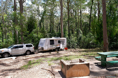
Our bush camp site at Bodalla Park Forrest RA.

This area was last logged in 1998. There are many straight and tall trees here now.

Thursday, November 28, 2013

Jamberoo and Shellharbour, NSW.

For our last full day in the Kiama area we decided to drive a circuit around some of the nearby towns. We left Kiama via The Saddleback Mountain Road and we were soon climbing to great heights until we reached the peak at Saddleback Mountain Lookout. From this point you receive a commanding view of the coast through to Port Kembla and Woollongong and west towards the Grandeur of the Sandstone Range of the hinterland.

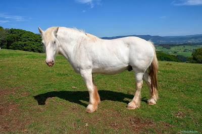
We met this fellow grazing alongside Saddleback Mountain Road. Clydesdales are a rare sight these days, especially a white specimen.

The sky is very hazy but Easts Beach is visible to the right and the headland to the left is the location of the Kiama Blow Hole and Lighthouse.

Looking towards the Sandstone Range in the background, Jamberoo is barely visible in the valley of the middle ground.

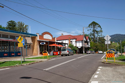
The main street of the small town of Jamberoo.

The Commercial Hotel, Jamberoo.

The Bowls Club House and Rinks, Jamberoo.

The School of Arts, Jamberoo.

Foreshore Caravan Park at Shellharbour.

Shellharbour Swimming Pool with Marina Rock Wall in the background.

Wind blown seas crashing into the Marina Rock Wall at Shellharbour.

The Ocean Beach Hotel at the bottom of the main street Shellharbour.

Looking down the main street to the Ocean Beach at Shellharbour.

Kiama, NSW.

We are south of Sydney now and can feel the difference in the climate. The days are sunny and warm but the evenings and nights can be rather cool. We decided to continue south on the M31 until we reached the Mittagong Off Ramp and thus bypass Wollongong and The Bulli Pass. We were surprised however by having to negotiate The Macquarie Pass down to Albion Park then Kiama. This Pass has 15 kph Hairpin Bends, quite exciting when towing a caravan. We could hear Transport Drivers on the CB Radio abusing car drivers that were crossing the centreline in front of them on the bends. We are camped in The Big 4 CP at Easts Beach, Kiama. The park is quite large and as you would expect from a Big 4 CP it is extremely well maintained. We heard of a 90 minute foreshore walk along the cliffs into Kiama township and the Blow Hole, we had to do it! The day was perfect so we had no excuse not to do it.

Easts Beach out front of The Big 4 CP.

A section of the rocky foreshore with the Kiama Blow Hole in the far background.

We soon came to the Little Blow Hole. As it sometimes happens, on this particular day the Little Blow Hole was performing far better than the Main Blow Hole.

The Surf Beach was providing some great waves for the Surfers.

The Kiama Lighthouse and Blow Hole is getting nearer.

The Main Blow Hole was rather disappointing today, this was the best photograph out of the five that I was able to take.

Jude in front of The Kiama Lighthouse. From here we went to the Kiosk and bought an ice-cream before the homeward walk.

Goolawah Community

During our southwards treks we always call in to visit and stay with our great friends Roger and Belinda at the Goolawah Community near Crescent Head. We always get to partake in terrific walks in and around Maria River National Park, this visit was no exception. On this occasion we walked across country to the coast. The total distance of the return walk was 12.7 km. You could say we were a little tired on our return to Goolawah Community but we had enough energy to down a few beers.

This was our last stop-over before we reached Goolawah Community. A large and well grassed free camp area behind the Shell Roadhouse at Halfway Creek, just 35 km south of Grafton. That is our caravan visible in the distant background. We are the only campers in  this photograph but we had many neighbours later in the day.

Halfway point of our bush trek, lunch on the beach. From the left Judy, Belinda and Roger. This and the next two photographs taken with my iPhone.

We had rain in the area a couple of nights previous to our walk and this meant we had to wade through water, sometimes above our knees, through about five sections of lowlands. Roger is leading with Belinda following then Lucas, a German visitor to Goolawah, then Judy. 

Another section of water and positions reversed here. Judy, Belinda and Roger.

Tuesday, November 19, 2013

Back on the Road Again.

Are we happy? Yes we are!

Judy and I have packed the caravan and joined the happy throng of travellers on the highways of Australia. This time we are motoring to Geelong via The Coast Highway. It has been over 16 years since we have travelled the New South Wales coast south of Sydney. It is time for another look. Along the way we hope to catch up with many old friends and relatives that we have not seen for many months and even years.

Our home took on the appearance of a disaster area as we packed clothes, food and other "essentials". There were bags and boxes all over the floors ready to be loaded into the caravan when I collected it from the caravan storage on Monday morning. With not to many interruptions from the neighbours we were able to lock up the residence and leave Hervey Bay at precisely 12:08. Earlier than I had hoped.

There is a free camp behind The Matilda Roadhouse near Kybong Creek. Many of our friends have stayed over night there but we had not. This was the time to trial the venue. We arrived in less than two hours but already many travellers had set up camp, but there was still space for us. Rain had finally been falling around the South East corner of Queensland and the New South Wales Coast so the area of the camp was wet in areas but still accessible to us. Toilets and showers are available at the Roadhouse, only a short walk away. Even though we were less than two hours travel from Hervey Bay we noticed the over night temperature was considerably cooler. So much so that we pulled our warm blanket out of storage and remade the bed.

Tuesday morning we broke camp at a leisurely pace and joined the traffic at 9 AM. Travelling down the M1 through Brisbane and the Gold Coast we reached our destination of Stott's Island. This is located on the Old Pacific Highway just North of Murwillumbah. We had camped here previously and was looking forward to revisiting. Amazingly we parked in the very same location as our first visit. This time, however, the rain has been here also. Many wet areas reduced the available camping space but everyone squeezed in for the night.


Matilda Petroleum Roadhouse near Kybong Creek. As seem from the Bruce Highway.

Matilda Petroleum is named after this fibre glass kangaroo. Matilda, the kangaroo, was a feature of the Opening Ceromony of the 1982 Commonwealth Games in Brisbane. Matilda has now been refurbished and happily resides behind the Roadhouse. Matilda is quite clever, being able to flash her eyelids, flick her ears and rotate her head from side to side.

The view from the Picnic and Camp Area behind the Matilda Petroleum Roadhouse.

Tortoise reside in the pond system along with hundreds of water birds of many species.

The view of Stott's Island Reserve from the Old Pacific Highway.

We managed to secure the same parking position that we had on our previous visit. Some areas of the reserve were quite wet following the recent rains.

Thursday, September 19, 2013

The Isa to Hervey Bay

Judy and I have had a wonderful four months travelling around The Far North of Queensland. We have seen much and learned much. We will return during another season, might be some grass and less dust then.

We pulled out of The Isa not too early on Saturday morning, actually it was just before lunch! We then had to be in Bundaberg to meet our Thursday morning appointment at Warburton Jayco to have some minor repairs completed on our caravan. By travelling about 200 km the first day and then about 400 km each of the following days we should be there safely and on time.

First stop was Fullarton River North RA (Camps 7/365) on the Landsborough Highway. Second stop-over was at Apex Riverside Park (Camps 7/347) at Longreach. Numerous camps already set up when we arrived and many more come in later. We had a local drop by and sell us a dozen fresh hen eggs for $2, great for breakfast next morning. So far it has been easy driving and this continued on the Capricorn Highway till we reached our next stop-over at Bogantungan RA (Camps 7/ 327). We and three other caravan travellers did a little cheating here. The actual RA is quite near the Highway, we drove into Bogantungan township and camped beside the Railway Station. Nobody told us to move and we had a peaceful night away from the trucks. The easy driving was soon to be over as we eventually reached and navigated over The Great Dividing Range. Turning onto the Bruce Highway near Rockhampton the tempo rose immediately. Dense traffic flows and some woefully slow caravan towers had drivers exasperated. I was thankful when we reach Calliope River RA until we drove in and found the area almost totally packed with caravans and motorhomes. We did manage to find an almost level area to stop. For the final leg of our cross State trek we had a reasonably short leg to Wallum Reserve (Camps 7/126) on the Isis Highway and just 28 km short of our Bundaberg destination. An early rise next morning and a short drive to reach our appointment at 8 AM. Following some rapid repairs on the caravan we were parked outside our front gate before lunch on Thursday.

The caravan is now cleaned and safely locked away in storage and that's all we have to report until our next caravanning adventure. We plan on being on the road again about mid November. I will look forward to compiling more Blog Posts as we are driving south along the NSW Coast.

Wednesday, September 4, 2013

Karumba to The Isa

In our usual manner we covered the short distance, about 600 km, from Karumba to MT Isa in the most leisurely way. Frequent stops with short drives in between. Driver fatigue was not going to wear me down. The road surface on The Burke Development Road is mostly very good, although there are a few single lane sections to take care of. Similarly there are also several single lane bridges to be aware of.

The first stop-over was at "Bang Bang Rest Area", only 112 km South of Normanton and 90 km North of Burke and Wills Roadhouse. This is a very large area that boasts Toilets and a Dump Point.

Another view of "Bang Bang Rest Area" with our neighbours from Merbein and Newcastle.

Everybody seems to take a break at The Burke and Wills Roadhouse. Tour Coaches, Road Trains and many caravanners. Absolutely nothing has changed at The Roadhouse from our previous visit 16 years ago.

There are still a few Cattle Road Trains on the road but far less that what there once was.

Many caravans though.

But not many staying in the Van Park Area.

The second night we pulled into "Terry Smith Lookout Rest Area". This is 103 km South of Burke and Wills Roadhouse and only 78 km North of Cloncurry. This is also a large area with toilets and a Dump Point. I was surprised to have Telstra Mobile reception here so we stayed two nights and posted the previous Blog.

Wide open spaces with many white barked eucalypts.

We called into Cloncurry only to top up the van with water and to stock up on groceries. We then drove 53 km West towards The Isa and pulled into "Clem Walton Park on The Corella Dam" This is the barren, dry and deserted camp and picnic area.

This is the reason no one is camped here, there is no water.

This is what it was like on our previous visit, not many years ago.

As it was deserted at the camp area we drove into the Boat Ramp Area and camped there like everyone else was doing. At least there was a little amount of water remaining.