Monday, December 22, 2014

Stokes Inlet National Park, WA.

We hadn't seen all that Esperance has to offer the traveller but moved along anyway. The proximity of The Christmas Break is pushing us to find a quiet sanctuary to camp in for The Festive Season. If possible we might return to Esperance after the School Holidays are over.

We had been told of a camp at Quagi Beach (kwar-gee) with limited sites at $5 per night and situated adjacent to a very long white sandy beach. We found that there were relatively small sites and minimal facilities but we paid for three nights to check it out. It seemed most of the campers were there for the entire summer period because of the low tariffs. Many of them had been here previous years. We felt uneasy about being there and left after two nights moving along to Stokes Inlet NP. This camp area has excellent facilities and friendly Camp Hosts Drummond and Jean made us feel welcome. It is the December Equinox, thus the beginning of Summer and it is raining! We've had about 25 mm here since yesterday afternoon and through the night. Other areas experienced double that amount or more. We will be having Christmas Lunch at the Camp Kitchen with the Hosts and the Park Ranger.

We plan to move along, heading inland again, on the Saturday after Christmas and Boxing Day.

The shoreline of Stokes Inlet. The Inlet is fed from two rivers, The Young and The Lort. The Sand Bar at the outlet is closed and is only forced open every few years after heavy inland rains.

This is one of four Camp Kitchens. All the facilities here at Stokes Inlet have been rebuilt following Bush Fires of 2006.

One of the many 'Bob Tail' Dragons that frequent the Park. This specimen is about 30 cm in length but we did see one that was at least 45 cm long.

There is a great walk through the Park that displays most of the natural flora of the area, Serrated Banksia here on the right of the path are playing havoc with my hay fever allergy.

Grass Trees are here too.

There are many Zamia Palms, this is probably the largest that is easily seen but there are hundreds of other smaller specimens.

While walking the path between the Camping Area and the Day Visit Area you cross a limestone rise. This is looking back towards the Camping Area which is around behind the small land spit seen in the middle ground.

From the elevated path overlooking the Day Visit Area Camp Kitchen. The Stokes Inlet Sand Bar is not visible but is to the right of picture. One negative point to the Park is that The Beach and Sand Bar are not easily reached from the Public Areas. There is no vehicle or walking track available. One must walk 3.5 km around the shoreline of the Inlet and this is not an easy walk at all.

One day we went for a drive further West along the South Coast to Fitzgerald River National Park. This NP is very different to Stokes Inlet, this being very rugged with steep rocky walks but it also has retained water similar to Stokes Inlet. Looking back East towards the small town of Hopetoun the water visible in the left middle ground is Culham Inlet and is also retained by a Sand Bar.

The rugged terrain of East Mt Barren.

On the drive out to Fitzgerald River NP we came across this gigantic Tea Set. People make this stuff to sell!

Thursday, December 11, 2014

Cape Le Grand National Park, WA.

While we were able to fit in plenty of walking around Esperance we also explored the wider area by driving out to Cape Le Grand NP and points further East. This touring day was quite leisurely and enjoyable except for one mishap, as I was taking the first photograph of the day the camera battery expired, it had zero charge! Fortunately I had my iPhone 5 with me, even though it was useless as a Mobile Phone, as there was No Service, it served OK as a replacement Camera. All the following photographs were taken with the iPhone.

Cape Le Grand NP. The beach, the Day Picnic Area and the Camp Ground nestled in amongst the trees in the background.

Cape Le Grand Beach and Headland.

There are several beaches in The Cape Le Grand National Park and they are all beautiful. This one is Hellfire Bay.

Frenchman Peak in Cape Le Grand NP.

A close-up of the Frenchman Peak.

The vivid white sands of Thistle Cove, Cape Le Grand NP.

While having lunch at Wharton Beach, Duke of Orleans Bay, this is outside the precincts of Cape Le Grand, we were under the scrutiny of two Skinks. One is here beside Judy.

We eventually discovered that they were after our lunch! This one has taken a liking to some residual mayonnaise left in the container.

The other one was curious about trying some Pink Lady Apple.

The fabulous Wharton Beach with unbelievably clean, white sands. The Duke of Orleans Bay is to the East of Cape Le Grand NP.

As we have been driving around these Southern Areas we have noticed vast amounts of these yellow blooms. Apparently it is Christmas Bush, this could be a common name, because it always flowers for the Christmas Period. The colour will change later to a deep red tinged golden colour. The Christmas Bush is a parasite plant living of it's host tree.

Esperance, WA

Oh, how we like the warmer weather! However, we also desire to discover the South Coast of WA as well. We had already delayed our South Coast travels by several weeks as a consequence of our Northern Goldfields Loop. The BT50 is now serviced and ready to take us a further 10000 km and we have no more reasons for delaying any longer.

We stayed overnight in two spacious Rest Areas on our Southward Drive and our first day in Esperance wasn't all that we had hoped for but the subsequent 3 days were superb. Esperance with a population of around 14000 is what you might say, a viable community, being home to most of the essential services but still small enough to retain a friendly atmosphere.

The town view from the Rotary Lookout Hill.

Still from the Lookout, over looking West Esperance.

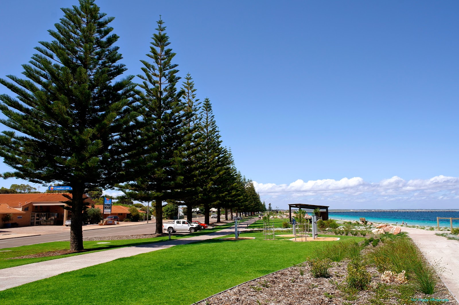
There has been a major revamp of the Harbour Foreshore Precinct that has only been open to the public for about one month. As you may notice whales feature fairly prominently in this region.

Cypress Trees from the original development have been retained but all the foot paths, lawns, gardens and BBQ Shelters are all new.

Sammy the Seal takes prominent position in The Tanker Jetty Precinct over looking the CAT COFFEE CARAVAN that was doing a roaring trade on this day.

The Tanker Jetty has also been refurbished and has only been re-opened since September 2014. The Jetty is now only for public use.

On Tanker Jetty looking back towards Esperance CBD.

From our Caravan Park it was only marginally over 2 km distance to walk into town along the white sand beach. The remains of an old timber jetty.

The view of the town and Port area as we walk along the beach into town. The Port area is quite busy with shipping being loaded with Grain and Nickel Ore railed from Kambalda.

Monday, December 1, 2014

The Northern Wheatbelt, WA.

We continue our South East travel through the Northern Wheat Belt. I define the area North of The Great Eastern Highway as 'The Northern Wheat Belt'. Visiting RV Friendly Towns such as Beacon and Mukinbudin (pronounced muck-in-boo-dun) among others. We stayed in The 'Mucka' Caravan Park for a couple of nights at $12 per night with no power and with brilliant Uni-Sex Ensuite Toilets and free entry to the adjacent town swimming pool. The people of the town are very friendly and make visitors feel welcome.

We diverted from our route to visit the quaint town of Westonia, where things are not what they initially seem to be. The Main Street buildings are constructed with modern materials but are made to imitate the original old buildings. Westonia is surrounded by cropping country but is also host to Edna May Gold Mine, the mine workings can be heard as you walk the very quiet Main Street.

Another diversion we made was to Karalee Rock and Dam. This Dam was constructed about 1900 to provide water for the Steam Locomotives on the newly opened Railway. The dam collects the rain run-off from a vast slab of granite in a very ingenious manner.

Since we left Bundaberg in early September we have wound on another 10,000 km to the Odometer, time for the next service and we have the BT50 booked into Kalgoorlie Mazda for that. As we have covered that territory previously we will not be publishing another blog post until we cover some new and interesting sights.

No guessing where we are now. The large banner on this implement tells it all.

This is a "Farm Made" tractor assembled out of a collection of parts. It was used continuously for many years.

The Information Centre is located in a shady position.

The old Mukinbudin Railway Station.

Memorial Hall.

Another of the well maintained buildings in the Main Street.

These Salmon Gums in the Caravan Park come in many colours, all at the same time.

The entrance to Westonia gives you a sense of what is to come.

The buildings are all newly constructed to represent the old town but what happens behind the facade is something else.

Behind the facades you will find all the services you would find in a similar sized town.

I think the Shire Offices were behind this facade.

This was one exception to the rule though.

This is only car parking space.

The Club Hotel is really a Museum of the original Hotel. Complete with fake Bar and Staff. Unfortunately it wasn't open during our visit.

Gold is part of the history of the town.

The old battery sits idle now days.

The town is very well presented and is a credit to the people of the Shire.

A private home gets in on the fun of the town as well with this Pink Elephant created out of a hand operated concrete mixer.

Karalee Rock, is a vast slab of granite that extends for about another kilometre behind where I am standing.

When there is a rain event all the run-off from the rock is diverted by the rock walls that circle the granite slab into this sluice channel.

The water flow then travels through this regulator gate.

The water flow then passes along this Riveted Steel Aquaduct that is supported by timber trusses.

The water then flows into the Dam where it was later pumped to the nearby rail line. The dam holds over 18,000,000 litres. As the water is collected on rock the contents of the dam is very clear.

Although the water was mainly harvested for the railway locomotives the authorities were realistic enough to make it available to the general population from this self filling well at two shillings and six pence per 100 gallons or 25 cents per 450 litres.