Friday, May 25, 2012

Murray River, The Riverland

We were blessed with near perfect weather during our stay throughout The Riverland Region, the nights were somewhat cool but the days were sunny and virtually no wind. We mostly stayed in Caravan Parks and several of these were situated on the banks of The Murray.

This is our final camping experience in South Australia, the next move will take us over the state border and into Victoria. There are several differences to other states when living in South Australia. The stand out difference is the fact that retailers do not supply carry bags, we could never come to grips with that one. We would shop at the supermarket then find ourselves with a trolley full of loose items that we would have to toss into the back of the wagon and unload individually when back at the caravan. Another individual quirk is the 10c deposit on all drink containers, under the bed was my storage area for the empties until we reached Renmark. There I took them all to the recycle centre and got all my deposits returned to me. The woman ahead of me collected $65.00. All along the Murray River region at most crossings one comes up to the free ferries, they operate 24/7, some places there are duplicate ferries for the two way traffic. Bridges are only constructed on the major highways.

This is the Murray River Queen, berthed at Waikerie. This is a sister vessel to the Murray River Princess that I featured previously. 

Waikerie boasts a river cliff top walk that provides great views of the Murray River and the extensive back waters that are evident in this photograph.

All areas along the Murray River have an irrigation past. This massive fuel oil powered motor once delivered water to the Waikerie Irrigation District. The 6 cylinder motor with a bore and stroke of 15" was built by Worthington, it produces 540 hp @ 260 rpm and drives the 24" pump that delivered 500,000 kph right up until 1965. This was 40% of the irrigation requirement.

It seems that all towns have a display of water pumps that were once used in the area. This one is in Berri. There is no information displayed but the motor is a triple expansion steam unit.

House boats on the Murray River at Berri with the Loxton - Berri Bridge in the background, no river ferries here.

Lake Bonney at Barmerah. Lake Bonney is connected to and contains water from the Murray River.

Just before sunset on Lake Bonney.

Located at Cobdogla, near Barmerah, is a fantastic Motor Museum. All the restoration is undertaken by volunteers. This motor is chuffing along and the engineer is going to give it a shot of oil from the oil can.

This motor proved to be very obstinate, it would not start for the engineers. Another exhibit at the museum was a Humphrey Gas Powered Pump. This pump is the only working model in the world and there was about 100 spectators waiting for it to start up. Unfortunately the volunteers could not coax it into life. One of the volunteers become overcome with gas in the Pump Pit. An ambulance was called and took him to hospital for observation. Two Ambulances, the Police and the Fire Brigade turned out with sirens blaring to the call-out. The Humphrey Pump has a 27 foot cylinder but no piston, the cylinder is full of water and when ignition occurs in the cylinder the water is expelled to the irrigation channel and a recharge of water flows into the cylinder from the Murray River ready for the next cycle. The pump runs at about 8 cycles per minute, when it starts.

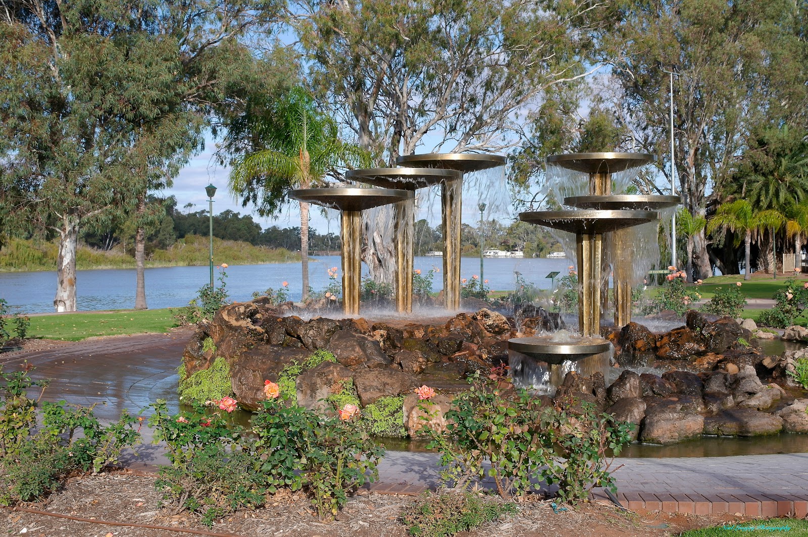
A fountain in gardens at Renmark with the Murray River in the background.

The PS Industry is berthed at Renmark. It only runs once a month on the last Sunday.

We were camped right on the river at Renmark. This large tuft of reeds just floated past on the speedy current of the river, most unusual sight!

The streets in Renmark are very wide and the main street, Renmark Avenue is divided by a central park strip.

The imposing Renmark Hotel, one of the grand old buildings in Renmark.

It is a hard life camping along the Murray River. Just watching the water flow by with the lift bridge in the background.

Our neighbours, Jan and Neil with pooch Sadie, at the River Bend Caravan Park.

The Murray River Bridge at Renmark has a lifting span to allow river traffic to pass through. The span only lifts at 9:30 AM and 2:30 PM and then only if river traffic requests it to open.

An old station house directly opposite us at the Caravan Park on the river.

Across the river from the Caravan Park is the town of Paringa. On display in the main street is "The Black Stump", a worms eye view.

Sunday, May 13, 2012

Murray River, Lower Reaches

Finally we have reached the starting point of our goal to travel the length of the Murray River. We saw where the waters reach the Southern Ocean after travelling through Lake Alexandrina but now we are truly following the defined course of the river. Wellington is the last town on the banks of the river before the Murray flows into Lake Alexandrina and that is were we start our photographic tour, to travel the river upstream, on this blog.

There are 11 free 24 Hour Ferries at various places along the Murray River in South Australia, this is the second one (from the river end) at Wellington. This is the river crossing used during the gold rush days to ferry gold travelling from the Victorian Gold Fields to the banks in Adelaide.

This was the ferry we used to cross the Murray, at Tailem Bend. You can notice already that the banks of the river are becoming high. There is quite a climb away from the ferry exit, the further we travel the higher the climb away from the river.

We stopped at Murray Bridge for lunch and I caught this couple having a sunny fishing afternoon. There are no ferries at Murray Bridge as they have a very large bridge, the first bridge constructed over the Murray River in South Australia.

We were stopped at a free camp at Haythorpe Reserve and only had to walk onto a ferry to cross over to the town of Mannum. This is the Main Street at Mannum and the river course is behind the shops on the left divided by an extensive parkland.

The white marker beside the dead tree is a flood marker, the highest flood was 1956.

I don't know whether this Pelican is standing guard or looking for lunch but it did not move from this perch in two hours.

The Mannum Reach (straight stretch) of the Murray River is the longest in South Australia.

The extensive parklands at Mannum are accessible from the Main Street (above/right) via small lane ways between shops.

The outlook from another free camp at Caurnamont. Here we met Debbie and Hugh from Maryborough and Ann and David from Hervey Bay.

Another free camp, this time Walker Flat, this time we were treated to a parade of paddle boats and house boats. This is the River Princess, a rear paddle wheel vessel similar to the Mississippi Paddle Boats.

The rear view of the River Princess, far better contrast with the camera focussing away from the sun.

It was only a short walk from our camp site to the location of the Walker Flat Ferry, here I managed to be lucky enough to catch a little sunlight on the sandstone cliffs bordering the Murray River.

The second paddle boat to appear was the Paddle Steamer Marion. Both paddle steamers were heading back to berth at Mannum.

Happy Hour at Walker Flat. This is the second time we have camped with Kaye and Rob along the Murray River. Rob is also a volunteer crew member on the paddle steamers in South Australia, he has been on the PS Marion as a crew member.

At various places along the road following the Murray River there are turn-outs at great view points, this is Forsters Look Out. Notice the amount of water behind the actual river course, it is like this all the way along the river, all the low areas are inundated.

The ferry you can see on the river is the Walker Flat Ferry. We had just crossed over on that ferry and have driven up a steep gradient to this look out point which is the same cliffs in the photograph a couple back with the sun shining on them. The free camp was on the left side about 1km further along from the ferry crossing.

This area of the river is noted for it's high cliffs, this is Big Bend, you cannot tell from the photograph but the bend actually turns through a full 180 degrees. Just two of the many house boats cruising the river. Where the house boats are moored there are BBQ facilities and the house boat occupants had stopped for lunch (and maybe the day).

Another Look Out point, this is at Swan Reach. We had thought about camping over there but it was only a very small area and too crowded for us.

Loch 1 at Blanchetown. This photograph taken from the Sturt Highway Bridge.

We are crossing the river on the ferry at Cadell, our current camping point. Once again you can see that the water is way beyond the tree line on the river bank. The current here is very strong as well. We are now above Loch 1. We have also left behind the hard water from the limestone area of South Australia. Our cups of tea now taste half reasonable.

River side cottages at Morgan. The Murray River travels roughy southward from Morgan to Wellington, before this point the river has been travelling in a generally westward direction.

The Murray River farewells Morgan around another bend and heads southward towards Wellington and Lake Alexandrina. 

Friday, May 11, 2012

Strathalbyn and Goolwa

Our plan was to use Strathalbyn as a base point to restock the pantry and to refresh the water and fuel supply. At the same time we were going to make a side trip to Goolwa to see Hindmarsh Island, The Coorong and the place where the Murray River waters exit Lake Alexandrina into the Southern Ocean. There is not always a flow of water through this point but following good flows from the Darling and Murrumbidgee Rivers as well as the Murray River itself water levels are at points not seen for several years. Strathalbyn is a very picturesque town in the Fleurieu Penninsula Wine Region of South Australia.

Travelling to Strathalbyn we stayed a night at this free camp situated beside the Nurrung Ferry. There were twenty people staying this night, including one traveller from Germany and two from Austria.

Our caravan is behind this small shelter. All of the campers gathered in the shelter for 'Happy Hour', this resulted in a raucous babble of voices each passing on important travel details.

The Nurrung Ferry crosses the Narrows, a strip of water linking Lakes Alexandrina and Albert. All the Ferries that cross the Murray are free and run 24 hours a day.

Strathalbyn branch of the Bank of SA, an imposing building in the main street.

The Laucke Milling Co. This building is still used to produce the bread making flour that we buy in Hervey Bay.

From one of the highest points in town this magnificent church looks over Central Park, Strathalbyn.

One view of the extensive Central Park in Strathalbyn. As the name implies, the park that borders the Angas River is really the central point of the town.

This photograph is typical of the look of Strathalbyn's Central Business Area.

Lake Alexandrina and the opening to the Southern Ocean, the point where the excess water from the Darling, Murrumbidgee, Murray and many other Rivers flows. This photograph taken from Hindmarsh Island.

A view of the Hindmarsh Island Bridge from the Goolwa Wharf area.

Looking under the Hindmarsh Bridge to the western reach of Lake Alexandrina.

A view of the Goolwa Wharf Precinct from the top of the Hindmarsh Island Bridge.

It was a Sunday when we visited Goolwa and there was an excellent market, it was very well attended by both patrons and stall holders.

On our return journey to Strathalbyn we took a detour to Milang, a small town on the shores of Lake Alexandrina. Another long jetty.

The foreshore park at Milang and the caravan park to the left. This would be a great area to camp in better weather and if you were into fishing.